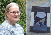
ABERYSTWYTH academics’ contribution to mapping the biomass of the world’s forests for the European Space Agency (ESA) are helping efforts towards tackling climate change.
Expanding and restoring forests presents an opportunity for countries to remove carbon from the atmosphere and contribute to national efforts towards achieving net zero, as well as multiple other mitigation benefits.
The latest version of the above ground biomass dataset, which uses satellite observations and was developed by scientists working as part of the Climate Change Initiative, makes it possible for the first time to robustly monitor changes in forest cover and carbon stock.
Previous maps did not allow biomass change to be measured between years, either nationally or internationally, partly because different satellites are used. However, the latest data set includes additional data provided exclusively by the Japanese Space Exploration Agency (JAXA) that has significantly enhanced the capacity for retrieving biomass at a global scale.
The project team, led by Professor Richard Lucas of Aberystwyth University, overcame this problem as part of a collaborative effort between ESA’s Climate Change Initiative and JAXA.
JAXA is producing dedicated data and processing high-volume radar data from the Advanced Land Observing Satellite (ALOS and ALOS-2) missions for the global above ground biomass maps.
Professor Lucas said: “This new satellite radar data provides excellent penetration of the forest canopy.
“By combining it with other acquisitions from ESA’s Envisat and Sentinel-1 satellites we improve calibration across the different years.
“This provides the fundamental basis for our consistent high-quality biomass maps.
“The collaboration between ESA’s Climate Change Initiative and JAXA has helped make a significant advance in how we monitor forest cover.”


