
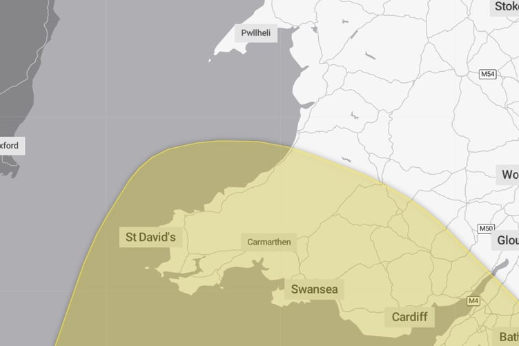
A yellow weather warning for strong winds has been announced for Friday morning.
The Met Office says winds could reach 70mph or higher across a large stretch of south west Wales between midnight and midday on Friday and could lead to transport disruption and damage.
Forecasters say: "Strong west to northwesterly winds may spread across southern parts of England and Wales on Friday.
"Gusts of 50-60 mph are possible and some coastal or exposed areas could see 70 mph or more, but at this time there is uncertainty in where the strongest winds will be.
"There will be some periods of heavy rain which will make travel more difficult. Whilst it will remain breezy the winds will probably ease late morning into the early afternoon."
There is a chance the strong winds could cause damage to buildings and lead to longer journey times or cancellations as road, rail, air and ferry services are affected.
Deputy Chief forecaster, Tom Crabtree, said: “An area of the forecast we’re particularly focusing on is the development of a potentially deep area of low pressure that could cross the UK overnight on Thursday and through Friday. It has the potential to bring some strong winds, though the location of the strongest winds will be determined by the low position. At this stage, people should keep an eye on the forecast and be prepared for some unsettled weather at the end of the week.”
Friday will be a widely wet and windy day, with the low pressure expected to clear into the North Sea later on Friday afternoon. This will pull colder air in across the UK for a time on Friday night into Saturday before the next Atlantic front reintroduces mild air and further rain.




Comments
We've recently changed our login process. If you have an account for commenting, you will need to re-register on the login window.
This article has no comments yet. Be the first to leave a comment.